THE LOOP is a lot farther and hillier. Yeah, yeah, I realize that there are those who do this loop with regularity, but I am not cut from the same cloth as these super heroes. I am a mere mortal. This was the most difficult 110 miles I have EVER ridden. I have ridden lots of centuries in my life. Maybe it's age or the fact that I don't ride as much as I once did, but this one defined my limits.
I got a slightly later start than I had hoped. I was not at all sure how long it would take but I knew I needed time. Originally I was suppose to meet a friend, her kids and Owen in Jackson at the climbing gym and it was only going to be 85 miles. That morning she informed me that she had forgotten about a prior dinner engagement she had but could still take Owen for a play date after school if I still wanted to ride. Hmmm....that means an extra 25 miles. Well, okay.
Contrary to Tony's suggestion, I decided to do the ride counter clockwise so I did not have to deal with the often formidable wind that blows west along Swan Valley and Palisade Reservoir. Of course that means I would have to end the ride with Teton Pass. Yuck.
I started out at about 10 am and headed up Pine Creek Pass. It is soooooo much easier to ride the pass heading east, short uphill and long downhill into Swan Valley.

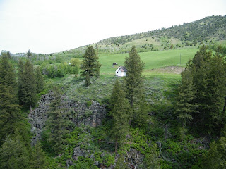
Swan Valley to Alpine is spectacular scenery. There were raptors soaring off the updrafts of every cliff and the reservoir was populated along the shores and islands with nesting pelicans. However, there was so much elevation gain I could not fully enjoy it.
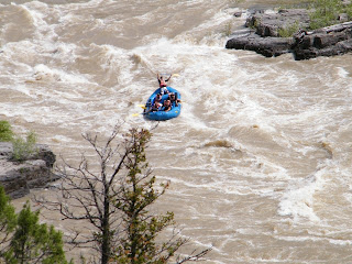
The road quality greatly improved the moment I entered WY; goodbye to chip-n-seal and inch-wide road shoulder. Rte 189/191, along the Snake River, is heavenly. There is a 3 foot wide shoulder almost the entire way and silky, smooth asphalt. It is also the best scenery of the ride, with the snow melt engorged river to the right and beautiful cliffs interspersed with forests of cottonwood to the left. Based on the number of rafts I saw careen by, the crappy economy is not affecting tourism too much in Jackson. I even got to witness an entire raft full of unfortunates take a swim at Lunch Counter Rapid.
My arrival to Hoback Junction was greeted by a thunderstorm that lasted exactly the 13 miles it took to limped into Jackson very cold and hungry. I opted to wait until Wilson to buy wool socks, eat Mexican food and steel my mind and body against the climb I had been dreading for the past 50 miles or so. I lingered over a Sangria soda and torta sandwhich hoping the pass would just go away. I considered sticking out my thumb and calling it a day.
Let's just say it is a lot easier riding the pass on a mountain bike with 29 gears. Under powered AND under geared is not a good combo. But I did get this great photo:

The last 12 or so miles into Victor were both glorious and painful. I was beyond happy to coast downhill but this feeling was tempered by the incredible cold that was seeping deep into my limbs. Mind you, at this point it was almost 8:30, in the low 40s and spitting rain.
Today I opted for a short run.


2 comments:
I still contend that clockwise it WAY easier.... you may have to confront the west wind along pallisades but it is gently down hill.
I contend that the easiest way is not to do it at all. The guys at Peaked informed me it was exactly a 118 mile ride. Don't want to cheat myself out of those lastest, painfulest miles, eh.
Post a Comment